
Try now with a 30-day free trial! Starting at $99.99 a year. Available on Android and iOS. Take us flying with you!
USA VFR & IFR Charts, Synthetic Vision, Procedure Plate Overlays, Flight Planning & Filing, Performance Calculations & More.

A set of weather tools you can depend on. Make your preflight decisions easier, your flight faster & safer. Includes Animated Radar, AIR/SIGMETs, METARs, Forecasts, Winds Aloft, and more.
Learn More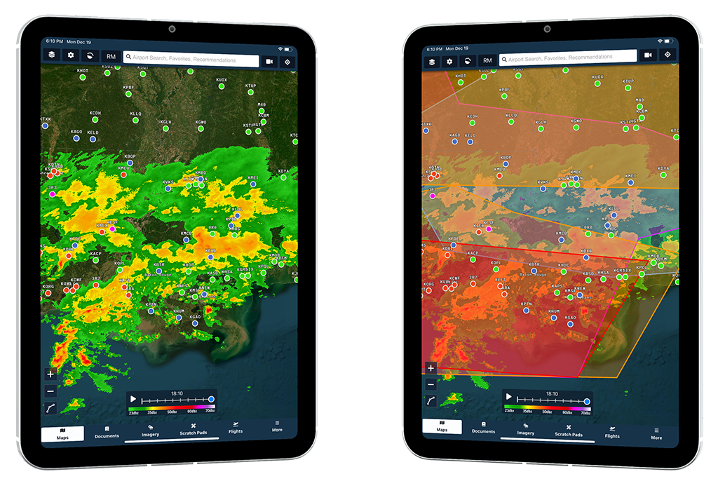
Make flight planning blazingly fast. Reduce your workload, get in the air faster, and have more time to enjoy the view. Your Aviator Assistant will recommend a route between points A & B and calculate realistic ETAs based on the current weather.
Learn More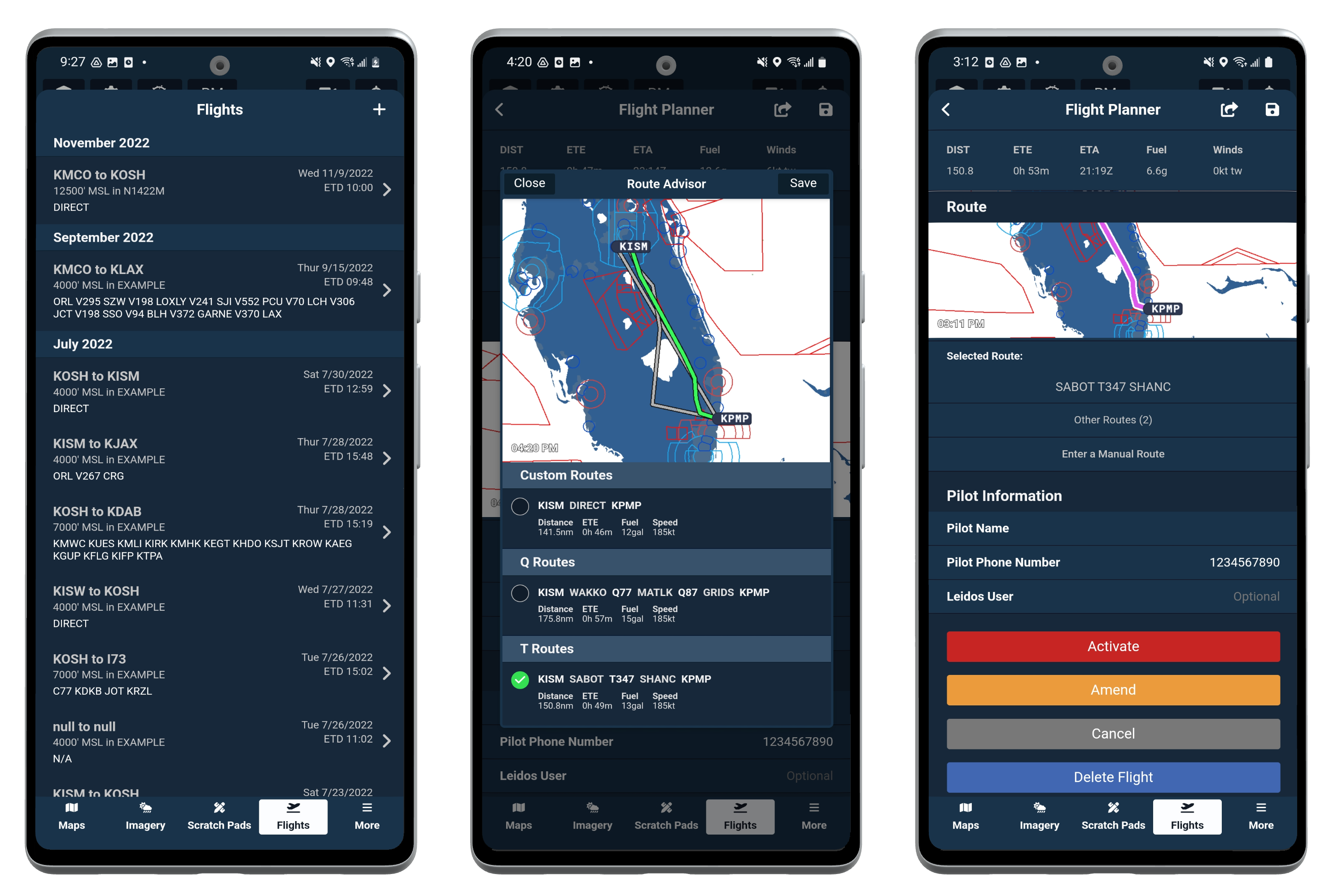

Aviator Assistant's Dark Mode makes sure that you can still see what's important while flying at night time. Everything looks and behaves exactly how you would expect.
Simplicity is key. Reduce the clutter in your cockpit. Aviator Assistant provides 6 different templates from which you can take notes on. ATIS, CRAFT, PIREP, etc. Use Scratch Pads to jot down notes, record weather and write down your clearances.
Learn More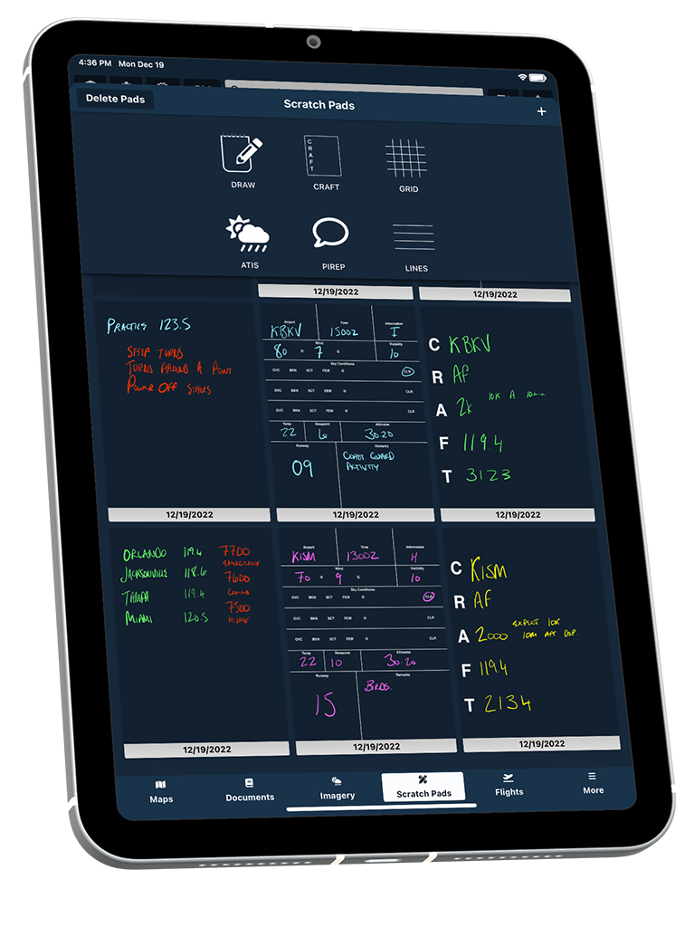
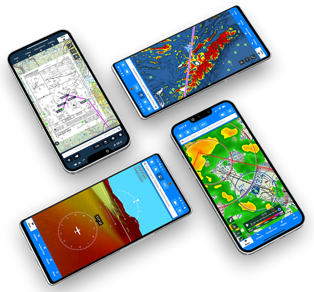
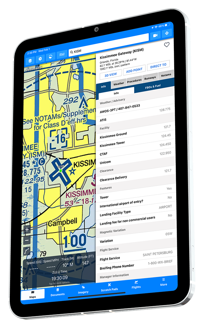
The information you need most at your fingertips. See communication frequencies, weather, forecasts, notams, procedures, runways, and more all in one place. Beautifully decoded METARs and TAFs. You will also see recommended runways and wind component calculations.
You can download specific procedures for offline use or all of them inside of Aviator Assistant's download manager. We help make sure you've got the information you need available offline while in the air.
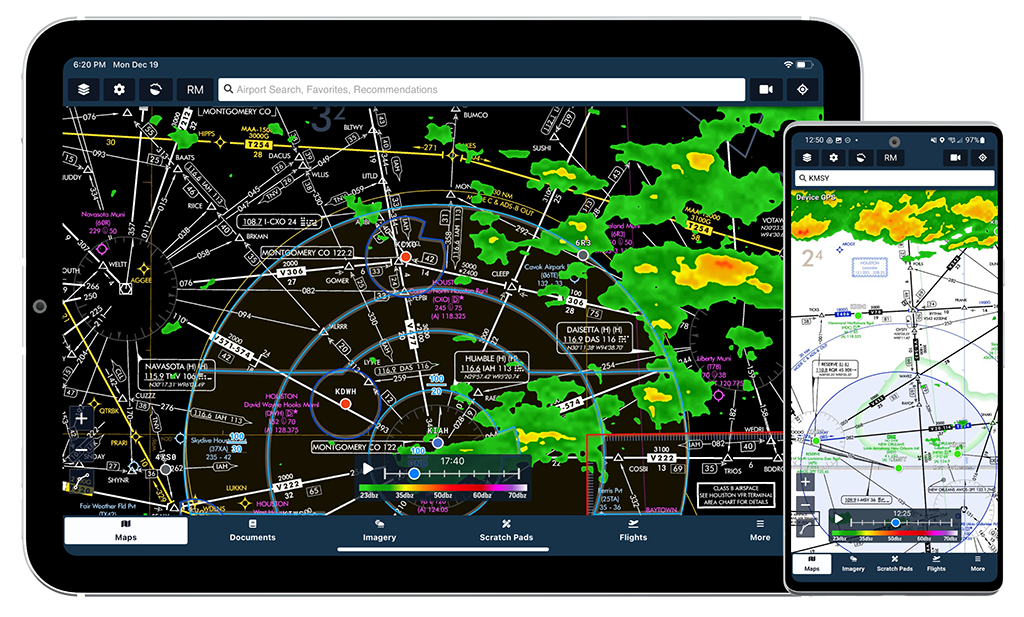
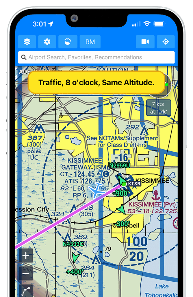
Using ADS-B integration, Aviator Assistant gives you real- time traffic reports and shows you where the traffic is relative to you. Using ADS-B we also provide Synthetic Vision with high quality and accurate terrain data. You will also see current NEXRAD radar data rendered to your map via ADS-B without an internet connection. Aviator Assistant also uses METAR and TAF information from ADS-B devices to help you make safe decisions. We're making sure you have all the information you need while in the air and on the ground.
We currently support ADS-B devices that use the GDL-90 Data Interface. Supported Devices:
- Stratus 3+
- uAvionics Scout
- uAvionics SkyEcho
- Air Avionics
- Dynon
- Stratux & Other ADS-B devices that communicate using GDL-90.
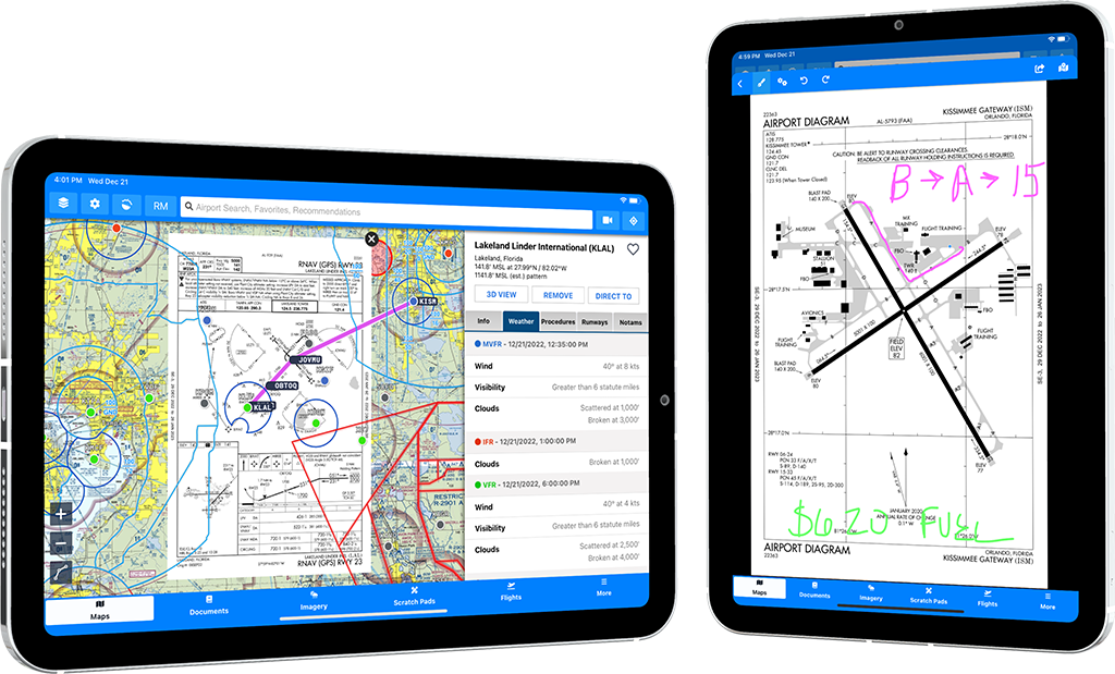
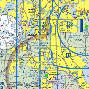
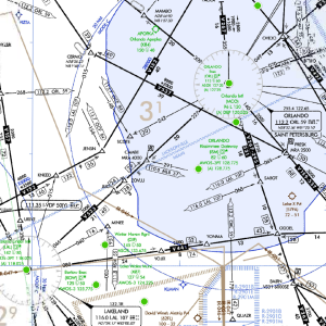
Overlay procedure plates and charts over the map and view your location in real-time while flying to improve your situational awareness and shoot excellent approaches.
Learn More